Site Moved

Try this link now for PhilatSea

Posted in Geocaching | Comments Off on Site Moved

North to Alaska

Celebrity Millennium

NOTE: Click on any photo to see a larger version

My  friend Harald recently booked a 7 Day Alaska  cruise  from Seward Alaska to Vancouver for August 23 – 30 on the GTS Celebrity Millennium.

At the time he booked it as a single but called me to see if I might be interested. At the time of the call I was dealing with a family problem of where a family member had suffered a major heart attack.
I declined the opportunity to go with Harald.

As I had been on 12 previous Alaska cruises Harald asked for my advice on what to see in each port.  As this was Harald’s first time I gave him what I thought the must do’s are in each of his port.
You see I did my first Alaska cruise in 1985 so I have seen the changes in 30+ years.

I fast forward to about a week before he was to depart and Harald called me again to ask me if he could add me to the reservation as the 2nd person. I won’t get into the details as to why one does this but it has to do with saving money.
I hung-up from Harald and mentioned to my better half and I was told I should just go as the family emergency was settling down.
I called him back and he said yes the offer was still on the table to go with him.

I began to make the plans of getting to Anchorage and then onto to Seaward Alaska.

Lets say my choices were not that great on short notice.
I booked a flight that looked like this. Vancouver to Seattle and sit for 6 hours then Seattle to Anchorage arriving at 0210 in the morning. The Bus left the Anchorage Airport at 0530 for the 2.5 hour trip south.
This allowed for a 3 hour sleep in the airport on a bench.
I have cruised out of Seward before and done boat tours in Seward but never spent any time walking around Seward.

When one books last minute so to speak there are problems that come along.
When you go to do online check-in for the cruise it has to be completed 48 before the day of the cruise.
Want something special order like distilled water is not likely going to happen.

Celebrity Cruises along with other cruise lines are slowly changing the way one cruises with the advent of apps for your phone to use while onboard the ship.
In April of this year I did a Tokyo to Vancouver on this ship the Celebrity Millennium.
The app was used and check-in was suppose to use the app but that didn’t happen.
Then there was the day we crossed the Dateline and had the same day twice, the app in fact crashed and that was it.

So once again I had to upload my photo to the app to be used for the cruise. Lets say it didn’t make it the ship for when I checked in.
So this is also one of the pitfalls of booking last minute.

I had made a decision to take a small suitcase on this trip which was a first for me. I did this because I get free laundry on the ship because of my past cruises.

I had planned to Geocache on this cruise like I do on all my cruises.
This would not be the first time caching in Alaska.
I have a good idea of what and where I need to go. There are few new caches in many places the ship stops.

I made a GSAK file of the caches in each Port

August 23 Anchorage (Seward), AK 8:00pm
August 24 Hubbard Glacier, AK (Cruising)
August 25 Juneau, AK 9:00am 9:00pm
August 26 Skagway, AK 7:00am 8:30pm
August 27 Icy Strait Point, AK 6:30am 3:00pm
August 28 Ketchikan, AK 9:00am 6:00pm
August 29 Inside Passage (Cruising)
August 30 Vancouver, BC, Canada 7:00am

I left on Thursday afternoon and checked into Vancouver Airport for my 1700 Flight to Seattle.
The one thing about Alaska Airlines is they open up the seats when you check-in for your flight 24 hours before departure. I moved from the last row to 2A at the front. While not a big deal in a Dash 8 short flight, I just do it. The same thing for the 2nd leg move from the back to Row 8C. Good thing I did on this leg as 30+ school kids boarded the flight and went to the back.

The flight left on time for Seattle. The decent took us onto the final approach for Seattle crossing just west of Boeing Field. Looking down there are sure a lot of 737 MAX aircraft parked everywhere.

737 Max Boeing Field

I have to say I was rather surprised after I deplaned and went inside. I thought I was going to be able to eat at either Ivers or Anthonys which are Seattle staple restaurants.  It would appear last spring that SeaTac had different ideas and both are gone.
Seattle is undergoing a major upgrade right now.

When Harald arrived we went and found a pub for a beer and food.

When that was done we headed for the gate to wait with the rest of the cattle.

Nothing eventful happened until the cabin door was closed and a passenger across from me decided to argue with the Flight Attendant about how she was told she should be in First Class for this flight and she wasn’t. The lady insisted that she be able to talk to a gate agent to fix it. She was advised that if the cabin door was opened at this point the lady could talk to the agent but would not be allowed back on the flight. The reason given was she had plenty of time to deal with this prior to boarding and the door being closed.

I went to sleep and woke just prior to landing in Anchorage.

Upon deplaning in Anchorage and going down the jet way  I could smell smoke. It was then we were told that there was a forest fire burning some 70 miles south of Anchorage since June and they were letting it burn.

Once we arrived in the terminal I had thought I would go Geocaching around the area only to find when I went outside I was feeling like a smoked Salmon.

Grab a bench and try for some more sleep.

Waking up at just after 5 we both cleaned up in the bathroom and headed to the bus location.  Arriving there in plenty of time we waited and waited when Harald’s phone had a text message asking where we were.
The driver was told to pick us up at the south end while we had instructions to be at the north end.
We were soon united with the driver and Bus and the only 2 headed to Seward.

The driver asked if he needed to wear the headset and we said no we are going to sleep.
We were told there was a stop halfway for the bathroom at a State Park.

I dozed along the way and managed to do a Virtual cache when we passed by.

A short time last we made a bathroom stop. Hey this were not your fancy bathrooms, they were plain old out houses.

There was a delay along the highway a short distance away at Moose Landing.
You see a few weeks before Snow Glacier above the town developed a lake of water that was 1/2 mile long and 450 feet deep. The one wall let go and there was a flash flood down river that badly damaged the Alaska Railroad and the highway itself.
This caused single lane traffic on the road and ALL Alaska Railroad trains to bus passengers to Seward.

Arriving at the cruise Terminal in Seward just slightly after 0800 left us with a small problem and that was where could we store our luggage.
The passengers had just started to disembark the ship and they were not at all ready for new ones.
We could say we were the first ones at the terminal for the cruise.

We found 2 ladies who were setting up a table near the entrance for those that wanted to check their luggage. We did just that and headed outside to board the shuttle bus to the town of Seward itself.
The bus makes about 7 or so stops around town.
We made the whole circuit and then stayed on to ride the bus down to the Aquarium. We declined to visit the Aquarium and continued on to look for a few nearby Geocaches.

The first one was called wildflower Mural cache. It took about 10 minutes before I figured out where this little bolt was hiding.
The downside to this one was the missing log. The problem is I normally carry spare logs but they are currently located in my suitcase that I checked at the pier.

Then it was off to one more along the water which didn’t take long to find and sign.

The next one was one I had seen before I left which was classified as a puzzle cache. It was called Book Smart, Not Street Smart. Reading the cache page one had to visit the local Library and then locate the book in the Library. The Book is called BIG Black Book.
So we entered the library and headed upstairs to look for this book. After back and forth several times Harald and I were unable to locate said book.
Harald made a small suggestion that maybe we should look at the computer for the book. I decided to ignore Harald and go talk to the Librarian. The Librarian suggested that I try the computer.
Well off to the nearby computer and look up the BIG Black Book. Sure enough the book was there and carried a Dewey Decimal number.
Off to find it, we soon had said book in hand.
Over to the corner where I opened it up and there were 2 containers in to book. One contained the Logbook and the other was for trade items.

GC454BTThe Big Black Book

As most Geocachers know Geocaching will celebrate 20 years next May.
I have been playing this game for 11+ years and cached in 44 countries around the world.
Alaska for the most part is still very much old school for caching as they still put some thought into caches that have been placed and still being placed.
I can’t say that where I live. That is the primary reason I don’t cache in my home area very often.
The 3 caches in Seward took me to places and had some sort of History or area view.
Alaska is still very much the last Frontier.

Seward Smoke
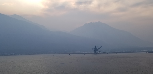
Smoke from the Fires

We then wandered around the city stopping in a place called the Chattermark
Harald I tried a White Lager that locally brewed that was very good. After a couple of beers we headed back to the pier to get our carry-on luggage and head aboard the Millennium.

We head to our cabin to get our key cards which are on the door in a sealed package.  A quick drop off of our carry-on and away we go.

I was on the Millennium back in May on the Transpacific cruise from Japan to Vancouver and saw the ship after her $75 million refit then.
It had been a few years since Harald had been on Millennium several years ago so he was interested to see the changes.

As the afternoon proceeded we had 2 different times for lifeboat drill one at 4:30 and one at 7:15 right in the middle of dinner.
It turns out that the later was true that we would do lifeboat drill in the middle of dinner.
I have to say in all the years I have cruised I have never seen Lifeboat drill in the middle of dinner.

After the drill we headed to the dinner where there was a table for set to dine for 8:00 from Cruise Critic.
The problem was this I was told when I booked that this dinner was scheduled and there was no room for me at the table.
I was fine with this but went along because there might be a chance someone doesn’t show.
As it turned out there was some major confusion with the Dinning Room Manager as we didn’t have the Cabin number of who reserved it. Once we got that we then found out they changed their plans and ate in another dinning room. Since it appeared that there was not room for us then questions started as to what next.
The Dinning Room Manager I knew from the Japan cruise so I stepped up and she recognized me. After the hellos etc. I said I was part of this group and we would love some help to get this sorted out.
Within minutes we had a table in a very nice location.

Hubbard Glacier

Today we sailed into Yakutat Bay in a low overcast and drizzle.
As we proceeded down the Bay and into Disenchantment Bay the rain appears to be letting up.
An announcement is made that the bow will not we opened to view the Glacier as it is raining and the deck is wet.
So the question is why are the upper decks open then? It is raining up there just like the bow. Maybe it is a different rain?

As we approach the Glacier we can hear and see the calving of the Glacier in front of us.
Hubbard Glacier is the only Glacier in Alaska that is still advancing. It has a height of between 12 – 14 stories.

The Captain spun the ship around 3 times so everyone got a great view.

While there the clouds somewhat lifted and the rain stopped.

I also managed to do the Earthcache that is located here.

I am often asked which is the better Glacier to see.

They all have their plus and minus. Glacier Bay used to have two Glaciers at the end but Grand Pacific is retreating and it is hard to see what is being left behind and what is actual Glacier. What is left is Marjorie Glacier. She is still offers great views.
As one sails into Glacier Bay you pass 2 more glaciers before you reach the end, Reid Glacier and John Hopkins Glacier.
The situation is this from May until early August the last two Glaciers are closed to viewing due to seals breading in the inlets.

Approaching Hubbard Glacier

Calving in the centre of the photoNotice how the change in light changes the colour of the ice. 

The early part of the season can have a lot of ice in the bay.

Some cruise lines offer College Fjord which is a series of Glaciers named after Ivy League Colleges. There are many of them that are of the Hanging Glacier type so they are not as grand as the others.

Juneau Alaska

This morning we cruised down the Fjord arrived into Juneau to low clouds and drizzle.
We drew the unlucky dock at the fuel dock which is a long walk into town.

During breakfast Harald and I discussed what we were going to do once we went ashore.

The plan was to ashore and look around downtown and go from there.

We left the ship and went to catch the shuttle bus which a few dollars round-trip.
As we stepped off the gangway the rain started and we headed quickly to buy the tickets and then for the waiting area.
The bus arrived and the rain stopped in time for us to board the bus.

Arriving at the drop off location we got off the bus and headed to Mount Roberts Tram.
As there was no line we decided to take the tram to the top and check it out.

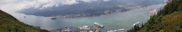
View from the top at the Earthcache Getting a bit crowded with Ovation of the Seas arriving Wind blown trees

Arriving at the top a short time later we got off and looked around the Gift shop. Typical Gift shop with all the things one would buy get them home and say what was I thinking.

We left the Gift shop area and headed out to find the trail for the lookout where I could do the Earthcache “What do Juneau about Glaciers?” that was up here.
It was a nice walk through the forest to the viewing point.

From here we headed back and followed the Alpine Loop trail the other way and locate the Alpine Loop Cache.

Looking for the Troll Found it!

The great thing is I have OSM Maps on my GPS and they have all the trails I need for up here.
I have written about OSM maps on here.

Once we completed this we had been up here for over 2 hours and maybe it was time to head back down the mountain and into town.

Once we walked into town we decided to stop at The Red Dog Saloon but the lineup was coming out the doors. Up the street we went where we found a very nice local establishment.
Harald decided on a Reindeer Hotdog along with a nice local Brew.

After our couple of brew it was back to the ship but not before doing one last cache back at the ship.

Working in a Gold Mine

Time for a light snack before heading to the Captains Club Lounge for Happy Hour.

The Captains Club is the Club that one gets a membership to after their first cruise on Celebrity Cruises.
There is different levels that one obtains for the number of cruise days they have spent on board one of their ships.
In my case I am Elite which allows me to attend Happy Hour nightly for snacks and free Drinks.

Since we had Internet here we decided to talk about what we were doing in Skagway tomorrow.
I thought Harald was going to take the White Pass Railroad up to Bennett Lake but he had decided that he wanted to go with me.
It was my plane to rent a car tomorrow and head north to Carcross and then Whitehorse.
I checked Car rental costs at Avis and it was about $150 USD for the 12 hours. We decided that we would wait until morning to get our car.

Juneau EveningBye Juneau

Skagway Alaska

This morning we arrived in Skagway and while it was overcast it was a pleasant day.

It was off to Tuscan Grille for Captains Club Breakfast where we discussed the days plans.

Once leaving the ship we walked into town to the Avis Office. Arriving where the Office used to be I found the area boarded up. A quick look around saw that the office was now where one used to pickup their car.

Walking into the very small office we asked about a car and soon found that the car we wanted and was available last night is no longer available and we would have to take a SUV (Subaru Forester) at a heart stopping $250 USD for 12 hours.
I think I just made a car payment for this rental.

We were soon in the car and off to places north.

The first stop was Gold Rush Cemetery to show Harald the history of those that lived here during the Gold Rush.

Once we left here is was north with a few stops along the way to show Harald where the White pass railroad was in relation to us and the terrain.

It was not long before we arrived at the Canada Customs crossing. We had to wait about 15 minutes while the buses jockeyed for parking to pick-up passengers from the White Pass Railroad Station.
We were now entering British Columbia.

One does not begin to understand how the miners climbed the Chilkoot Trail through the Chilkoot Pass and onto Lake Bennett.
There was a second trail called The White Pass Trail which was 10 miles longer and had it’s share of problems.

As one drives north you begin to understand the challenges that these miners faced when you look at the terrain.
There is one thing for sure and it is pretty unforgiving country.

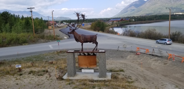
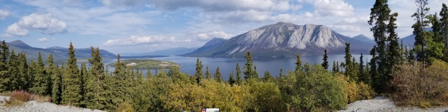
We arrived in Carcross and stopped by a lookout area I was at a few years back. At that time Bennett Lake was frozen over. It was a fantastic day here this time.

Cariboo LookoutCariboo Lookout cache – I did this one a few years back and the Lake was frozen over

I then looked at my GPS and noticed a small problem. I did not have any Geocaches on it for this part of the trip.
I had to go via memory from my last time here as I had 2 Did not Finds on that trip.
A slow drive over to the Tutshi Memorial which is a old stern paddle wheeler.
I looked for the cache while Harald looked at the Memorial and what is left of the Tutshi.
I managed to find the cache quickly and joined Harald for the rest of the visit.

From here we headed north and stopped briefly to do the Great Cariboo cache.
I soon found this and signed the log.

Back into the car and north to Whitehorse but not a long way up the road I showed Harald the most northerly desert in the world. I decided to stop next at Emerald lake. I have been here before but it was too early and frozen over. Not today it looked fantastic.

Emerald LakeEmerald Lake and there is a Earthcache here

The one thing we did notice was the changing of the colour of the trees as we left the lake.

We came to our next turn which was a turn onto the Alaska Highway.

From here we continued into Whitehorse and proceeded to the airport. I wanted to show Harald a few things such as the worlds biggest weather vain. Then there is the Transportation Museum.

DC 3
What I wanted to show here was the machinery that was used by the US Army to build the Alaska Highway. When the US Army completed the job they just left everything behind.
There is also a river boat that was used to move people up and down the Yukon River.
If you want a closer look then visit the National Historic Site of the SS Klondike.
There is a very nice trail along the Yukon River that has many caches along it.
I suggest stopping by a cache called The Copper Nugget.

Yukon RiverYukon River from the trail

If you want to see early Yukon then stop by the MacBride Museum. How it has changed since I was here.

There was no building built over it last time I was here

We continued into the downtown core to find a Tim Hortons which is a Canadian Coffee House. I have to admit it has fallen off in recent years with it being taken over by Burger King.
We needed something to snack on and I needed my cup of tea for the drive back. Harald suggested another fine establishment where we could have a beer with our lunch. I said sure but I am telling you now I am not having a beer as I have a rule that that I drink NO alcohol when I drive on roads like this. Too many tourists not paying attention.

Harald decided to try the latest craze of the Beyond Meat Burger. I suggested that this would not be the place I would try one as this is a coffee house.
The next indicator was the 10 minutes we had to wait for it.
Harald tried the Burger and said he can now say he has tried one, it will be his last one.
I took my Tea to the car and my box of Timbits that was going back to the ship.

Ready for the Road
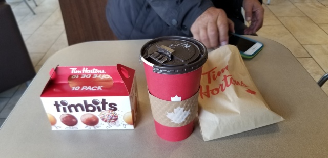
Ready for the trip back

While I may be a tourist myself I have been in the north many times and aware of what to watch for.
Whitehorse has a weekly flight on Condor Airlines from Germany that drops people off here. Most of them rent Motor homes and tour for 1-2 weeks at a time. They stop without warning, turn without warning etc. One can get lulled into a false sense of no one being on the road with them, hence the sudden stop, turn.
Then there are animals such as Bears, Moose, Caribou and Deer to name a few more of the things on the road.

When we headed back towards Skagway and were about to turn onto the Alaska Highway Harald asked me to stop because he never thought he would ever get the chance to drive on the Alaska Highway.

There wasn’t much to see on the return trip south.
We managed to stop at the Yukon Border this time as there were many Tour Buses at it on the way North.  The other reason was the last time I was here I had to leave the cache here because it was covered in snow.  Not this time, I signed the log on was on my way.

I am standing in BC and the Yukon is behind me.

It wasn’t 5 minutes later when we were quickly gaining on 3 motor homes.  Suddenly they stopped on the road and jumped out. No they didn’t pull onto the shoulder even though there was lots of room.
I saw why with 3 moose in the lake beside the road. I pulled off the road up the way where we managed to walk back and view the wild life.

There is a baby Moose behind.

We left a short time later and the US Border Station was upon us. A quick stop and we were on our way.

On our arrival back in Skagway it was fill the car with gas and return it.

We then walked back to ship in time to get changed and head upstairs to Happy Hour.

When one arrives at Happy Hour and places a box of Timbits on the table people start asking questions as to where we hot those. They didn’t see a Tim Hortons in Skagway. I said we got them in Whitehorse which of course would get Whitehorse how/when. Explained rented a car and went North.

I had brought the Timbits back for the Captains Club Hostess Edrilyn but she was not there.
After an hour or so I offered one to our Appy server. She had never seen them before and tried one and said those things are good where can I get them. I had to explain in Vancouver across from Canada Place.
There was our drink waiter who got the next one.
It was down the last 15 minutes and our Appy server was back for one last round and I gave her a 2nd one and told her that if Edrilyn didn’t show then she could have them. She offered to Call Edrilyn and get her up here, which she did.
Edrilyn arrived and I presented the last 7 in the box to her to Thank her for her hosting the nightly Happy Hour.
She went into the back room to try one and came back and said she needed more of those to take on the Transpacific in 2 weeks.
At the end of Happy hour Edrilyn came to Harald and I asked if we would like to attend sail-away on the Bow tomorrow with the Suite Guests.
Lets say Yes wasn’t too hard to say for this.

Icy Strait Point, AK

This was an early arrival today.

We remained in bed well after the ship docked.

There was no hurry to get off the ship as there are no Geocaches here in Icy Straight.

Looking out the window we could see forest and then some buildings once we woke and opened the curtains. There was a overcast layer of cloud looking like it could rain.

It was off to Tuscan Grille for Captains Club Breakfast and then get off the ship.

Around 10 am Harald and I headed ashore to find out what the wilds of Icy Straight point offered.
There appears to be several walking trails and then a trail into the start of the area built for cruise passengers coming ashore.
As we got farther in we could see several buildings including a building where one starts different tours.


From what I saw I saw few Tlingit Natives working the different venues.
I am not sure why this is, but I have my own thoughts on this.
In BC we have many First Nation People that claim they want work and when work is provided it is turned down.
I will use an example of this where the Band was given a land settlement and the right to Govern themselves and tax people. The band provided the land to build a huge mall and build condos. From this the Band would get the tax money for the band.
The money is then provided to Band Members monthly. The problem was when the mall opened very few if any of the band members took jobs in the mall. It had been said that why take a job when one can sit at home and get a monthly payout from the band.
It is sad and needs to be looked at how to fix the mind set on this.

While it is true that Icy Straight has a mean looking zip-line I am not sure that this is a true Native experience.

You start from the top of the Mountain

If one wanted to do something that Natives in this part of the world know about it is Whales and I would suggest this would be the place.
Whales are a Big part of all Coastal Native Bands and they can been seen on the many Totem Poles up and down the west coast.

Harald and I got back to the ship a few hours after we left. We had a bite to eat and noticed it was starting to clear.

The time came to head to the Bow for sail-away. We put our Jackets and hats on and headed out. Arriving at the Theater we met up with the group and started the trip to the bow.
The sun was out and we looked out of place with our Jackets etc. We grabbed a drink from the table and waited while the lines were let go. I mentioned to Harald that once we started to move many on the bow would be departing as they were not dressed for what was coming.
The Celebrity Eclipse was now coming in to replace us.
EclipseYes it doesn’t look bad…right now Doesn’t get better than this in late August

Sure enough the cold wind started over the bow and people started to leave. Now we didn’t look as out of place at all.

Ketchikan, AK

Arriving in Ketchikan  this morning was pleasant as the weather cooperated and it was very nice.
I have to say over the years I have been very lucky with the weather here and avoiding the rain.

Ketchikan from the ship as we dock.

Stepping off the ship is interesting because your right downtown and on the pier is the rain gauge on how much rain Ketchikan has had to-date.
Now if you forgot to bring a jacket this is the place for you. Stop at the Tongass Trading Company  store to buy a nice jacket for $20. The funny part they have been $20 as far back as I can remember.
Oh yes need that wooden train whistle for the Grandchildren, this is the place to get one of those too. It will surely do the trick of driving the parents nuts well after you have left.

The plan for the day was to take Harald over to the Red Bridge at the start of Creek Street.
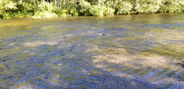
At this time of year the Salmon are returning to spawn upriver by the thousands. If you have never seen this before it is a sight to see.

A word of caution here if you visit during this time of year. You will see many people fishing from the bridge and reeling in fish which they promptly gut and clean right on the sidewalk. They do not clean up after themselves.

Creek StreetCreek Street from Red Bridge

We proceeded up to Creek street which was best described in the 1920’s as fishermen, bootleggers, & prostitutes.
From different viewing areas we could see hundreds of salmon fighting their way up stream trying to avoid the seals in the river.
We crossed over a bridge at the end of Creek Street to view things from the other side. We managed to see the seals having a food frenzy just taking out a bite of one salmon at a time.

salmon
Proceeding back over the bridge we decided to proceed up Married Mans Trail to the Fish Ladder where we see the salmon using it to bypass the rapids.
As we proceeded across the street to view the river we could see thousands of fish resting in the river waiting to proceed farther up the river to the hatchery.

Salmon resting

We continued up the road along the river until we came to a Geocache that we were passing by. This is a Travel Bug Hotel in the front area of an Apartment Building. Lets say it is a very large ammo can. I soon logged the cache then we carried on.

Arriving at the Deer Mountain Fish Hatchery we went inside to take a look around. We saw the rearing tanks for the Chinook salmon.
The hatchery releases 100,000 Chinook smolt into Ketchikan Creek a year.

Deer Mountain Fish Hatchery

Hatchery’s play an important part in sustaining the Salmon fishery on the west coast of Canada/USA.
I will suggest that if you can visit one please do. It is amazing that the Salmon come back to the place they were spawned.

There was a free city shuttle bus from Totem center next to the hatchery that took us back down town.

When we got back to town we headed off to do 3 Geocaches one at the rain gauge and 1 virtual at the statue next to the Gauge and then one at the large Bald Eagle at the other end of the pier.

Virtual cache

I have to say that there are many interesting places in Ketchikan even if you don’t Geocache.
As far as geocaching goes there is enough trails out of the downtown to take up most of the day. Just remember that early in the season is Bear time. Take the precautions needed to keep yourself safe. This goes anywhere in Alaska early on.

Totem Pole

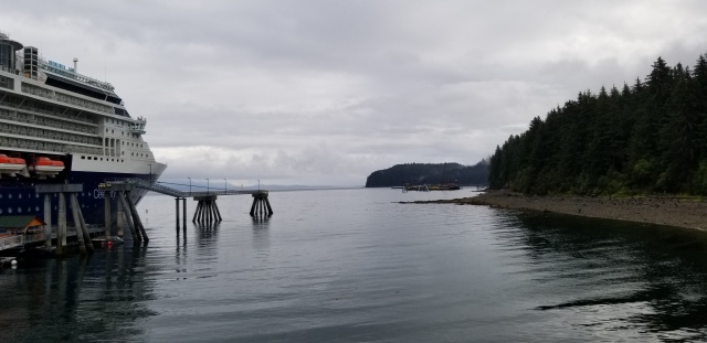
The best part of leaving Ketchikan is sailing out of the Harbour either north or south is the beauty of the area. Find a place to sit and take a look at what you sail past, the scenery changes every few minutes.

While the ship sailed at 6:00 PM everyone has to be back onboard by 5:30 PM. I suggest you don’t be late as the ship WILL leave you behind.
We went upstairs to Happy Hour and picked a window seat for the next 2 hours as we sailed south. There was only one whale sighting and that was as we left Ketchikan harbour.

Cocktail Hourview

Inside Passage (Cruising)

Today we sail south and currently in open water of the Pacific Ocean.

Some cruise lines head inside south of Prince Rupert BC and take the same inside passage that BC ferries takes. This is a spectacular area to sail.

As we approach the northern tip of Vancouver Island we take on 2 Canadian Pilots for the rest of the trip to Vancouver.
For those that are headed to Victoria/Seattle you will be sailing the outside of Vancouver Island.

later on this afternoon will will approach an area called Robson Bight that is a protected Marine Wildlife reserve for Killer Whales. The Killer whales use this area to rub their undersides on the rocks here.
many people are not aware there are 2 types of Killer Whales the resident Pods and the Transient Pods. Resident pods eat Salmon while the other eat seals etc.

What I am saying there is a great chance that one should see some form of whale activity.
Today we only saw 2 Grey Whales.

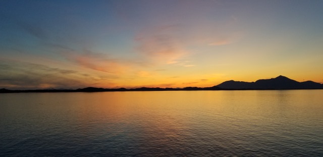
Today we spent most of the day just watching the world go by and talking to people we met onboard.

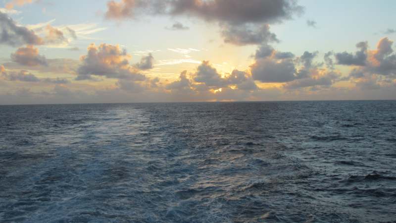
We had the most magnificent sunset.

Sunset

Conclusion

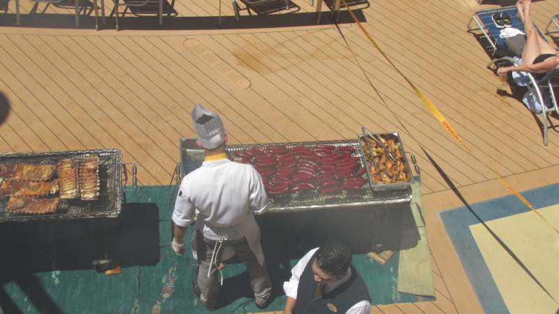
I failed to talk about food and many other things onboard the Celebrity Millennium.

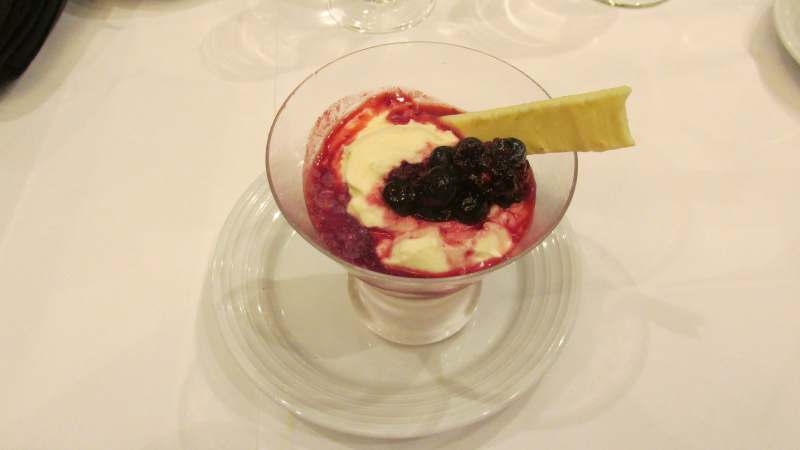
Food is a very subjective between passengers. While I have done Alaska many times on different brands Celebrity food is a notch above the other brands for the most part.
Having said this the one thing that most passengers look for onboard a Alaska cruise is Salmon.  There is wild Salmon and farm raised Atlantic Salmon. Almost all Salmon served on a ship anywhere is Atlantic Farm Raised. The Salmon is raised in pens both in BC and Argentina and fed coloured feed to turn the flesh pink.
Farm raised also have a sea lice problem that is becoming at problem for wild salmon.
I will ask what salmon a waiter/restaurant is serving before ordering.
For instance Celebrity has salmon available every night at dinner and you can bet it is Atlantic Farm raised.
I found that on our cruise when Salmon was featured on the menu it said Wild Pacific Coho Salmon.
Holland America makes a BIG point of serving wild Salmon on board especially when the Copper River Salmon is caught. Holland America’s head office is in Seattle so they understand the Salmon issue.

The Millennium went through a major refit back in March where the ship was almost gutted and rebuilt. The ship for the most part is great. There are several things about this ship I noticed back in May when I was on her that were still a problem. The showers in the cabins are having a problem with the grout coming up between the tiles. There is still paint over-spray down the halls around the doors.
I did notice something new this time in Icy Straight Point. Celebrity changed the hull colour of the ship to a new colour of blue. A ship needs constant painting and it appears the deck hands were using old paint because there were large areas of the “old” blue.
On a positive note I did notice a change in the bathrooms on the shelves where they have added a wood lip to stop things from sliding off.

Cruising and Geocaching

I started cruising back in 1983 and starting Geocaching in 2008 and thus combined the two things to have a great time.
Yes it takes planning to find where you want to go and where the Geocaches are that you may want to do.

There are several things that can happen if you want to cruise and Geocache. Do you want to do the work on your own, or join a Travel Agent group that has put a Geocaching trip together.
I have helped assemble a group for a cruise that had about 550 people on the cruise along with a few smaller cruises. So I have some experience in this matter.
I have gone cruising with about a dozen cachers who I have met over the years cruising.

If you decide that joining a Travel Agent Group sounds interesting consider several things before you put the money down.
– How many people are going on this trip.
– What is the cost vs doing it on your own or with friends
– Am I/we going to achieve my goals for the trip?
– What extra perks am I going to get if I book this cruise with a group?

The old saying the more the merry isn’t always the case especially when it come to Geocaching.
Think about it this way. Buses in North American can carry upwards of 55 people.
Do you want to be following the leader to the cache  to sign the log? Will you accept a Group Stamp as your proof you were there?
There will be that “slow” person who wants to sign the log then stop and take several photos and be last on the bus.
There is always that Geocacher who is a high time cacher that only wants to do quick caches because he is a numbers guy and doesn’t want to do quality caches no matter what was agreed to before you left for the trip.

The cost of the trip could be very high compared to what you could do on your own.
Look at what is included. Does the group provide a bus in each port Is there a cocktail party provided for the group.
You see when a group is formed the normal situation is that with every 8 cabins sold the Travel Agent is given 1 cabin. Based on this formula the Agency stands to get 7 cabins for a group of 55.  There are several ways to deal with these cabins. The agency will sell them and this is pure profit. So if the trip is $2000 PP that is $4000 per cabin x 7 or roughly $28,000 to the Agency depending what type of cabin is sold.
Some groups I have done have put this amount back into the group reducing the cost for everyone in the group. There is an option to add perks such as the Cocktail Party or Group Jackets or put it towards the buses for the group.
In some of the groups I have been asked to look at by fellow cachers I was amazed at the prices they are paying. vs. what they are getting.
In one group I looked at the group appeared to be paying upwards of $500 pp above what I could see the cruise being sold for. Then the group was to pay for buses once they got into port that had been arranged for them.
So stop and think about this, another $26,000 is being made on top of the $28,000 for $54,000.
The next question one needs to ask if the cruise price goes down prior to final payment does the Group price go down. This happens more than one would think.
If the cruise price does go down you should benefit from it.  Some Agency’s don’t like dropping the price due to the fact they loose commission but lets be real here they are still making good money.

When one plans for this type of Group get as much information as you can as to where you will be stopping and what you will be seeing. I heard that recently a trip stopped at many Guard Rail caches, we have all seen far too many of these. Is this what you went to Europe for?
When I go caching off a cruise I try and look for local attractions and see if there is a cache nearby. I may walk to it if not far, take a train or a bus.
I have been known to walk 16+km around a city.
I have seen some pretty amazing things along my travels like the Snail in Venice Italy, or the old Greek Church in Athens built about 1050 and still being used today.
I can tell you I have been in some pretty interesting situations  but always got back to the ship without problems by using my brain. Think about where you are, what Country you are in. Will placing a cigar tube back behind a electrical box with a Police Officer with Sub-Machine Gun near by draw their attention. (Yes this did happen to me)

Your goals need to be set before you book and then during the booking process are those goals going to be met. How many of them are going to be met.

Every Group cruise I have done has had perks in one way or another. They could be a reduction in fare like I discussed above.

Now ask yourself this, are you going to cache with a cellphone or a GPS. Cellphone can be damn expensive if you decide to roam.  I was in Vietnam where one of the group decided to use their phone and got back to the ship with a $200 charge for data roaming.
Open Street Maps work all around the world and can be downloaded for FREE!
I have used them on every trip and not had a problem.
If you see a cache near a place that you are going to visit and it is disabled for a period of time put a note on the cache for the CO asking if he intends to replace it. If no response after 7-10 days put an Archive Notice on it. This will either get it replaced or the CO may email you and ask you to replace it as he won’t get back there for a few more months. The worst is it gets archived and shows the CO had no intention of replacing it.

Lastly as I said this was trip 13 to Alaska and I love Alaska. I have even made a sheet up of how to plan a trip to Alaska via cruise and how to get around  in the different ports for friends that plan on going to Alaska.
Alaska has some great caches in every port.  Skagway has a great 2 old time Virtual caches. Juneau has many Earthcache. Then there is Glacier Bay, Hubbard Glacier Earthcache.

On this cruise it cost me about $1000 CAD including Air to Anchorage and transfer to the ship and rental car. I had an outside cabin as well.
Many ask me why I don’t put Geocaching groups together and there are many reasons. I have tried to do a few but when push comes to shove many cancel killing the group.
This is why I keep it to friends who want to join me.
The next is if you are not careful you can loose a ton of money. I had a Travel Agent who was doing one of the groups go Bankrupt as a result of the group because the price dropped.

I have seen some very good pricing for summer of 2020. I have pointed several fellow cachers to some of the prices I have found.

Posted in Geocaching | Tagged , , , , , , , , , | Comments Off on North to Alaska

Garmin FREE Routable Maps – May 2018 Update

I have been lucky to travel the world Geocaching along the way.
The problem was maps were a big problem. I remember going to Europe in 2009 and buying Garmin maps that took forever to draw/move.

Then there were free maps by Ibycus but they were NOT routable.  That means they would not tell you how to get from point a to b.

Then Open Street maps (OSM) came along with a version for Garmin GPS that were routable.
Since then I have not looked back.
They are FREE and pretty much cover the globe. I have used them in China, India, Vietnam, Japan to name a few places and they have been good.

The best parts of these maps they are updated every 2-3 weeks and they are FREE.
Maps you buy from Garmin are on average using data that can be as much as as 12 months out when the map is published.

I am amazed that many out there that use several models of Garmin GPS still don’t know that their GPS can be loaded with FREE maps. Look at you specs of your GPS and see if has the ability to add maps, if it says yes then this should work for you. The site is called Free worldwide routable Garmin maps.

I know the Garmin 62 series, Gamin 64 series, Oregon 300, Oregon 450, 550, 600, 650, 700, 750,  Garmin 78 series, Montana series, eTrex 20, 30 accept these maps.
Now a word of caution the early Oregon have a size limit to the microSD Cards of 4 GB while other have upwards of 16 GB limit.
I have the 62S and 64S and have found these maps to be very good and the best part they are routable. What this means is you can get turn by turn directions from point A to B or the geocache. These maps are updated on a regular bases and they allow users such as yourself to upload tracks to place in the may of new roads or trails.

Something new that has been added since my last post on this is you get a choice of the type of map you can select such as Generic Routable (new style) which shows more detail such as tunnels.

So once you open the page you have to select the type of map. I recommend Generic Routable (new style) now.

You then have to select the map for a particular area such as a Province/State or Country, in this example I have used British Columbia (BC), if that is all you need. If not skip down to Custom Maps

Now once you have selected BC you can now download by going to the link in the screen shot below.Click the download map now!link and you will see this:

Click on the photo above or any photo in this blog to see a larger clearer version.

You want to select the bottom link osm generic new gmapsupp.zip

Once you download this zip file you have to unzip the file. This is done by double clicking on the folder and once it opens you should see a file called gmapsupp which should be a disc image file.
Save it to your desktop and then right click on it and change the name to this gmapsupp.bc as this is a map for BC. If it is a Country then change it to gmapsupp.countryname.
The reason you need to add/change the name is because if you add another map named gmapsupp it will overwrite the map already there.

Once this is done you can place it on your microSD card. I suggest either connecting your GPS to your computer and locating your memory card if you have one or taking a new microSD card and using the adapter and insert it into your computer, the later is much quicker.
If your microSD card is new you have to add a folder called Garmin. If not and it was used for something else you have to format the card then add the Garmin Folder.
Once this is done open the Garmin folder and drag gmapsupp.bc  or other such file into this folder or send it to it.

Once this is done the above remove the microSD card from the adapter and insert the microSD card into your GPS.

Now turn on your GPS and go to map set-up and see if the map turns up in the menu. It will show up either of one of two ways Enabled – OSM World Routable or the name you just gave it or Disabled, if it is disabled then enable it.

Now go to the map and the area you downloaded and make sure it is there.

I will now explain how you to make a custom map.

You can not download a separate OSM Map say for BC and Washington and place them on the same microsSD card as along borders you will end up with a thatched area.
The reason for this is that each map set shares the same tile for each map set along a border. The GPS does not know how to read two tiles at the same time so the area shows up thatched.

can-us border

As you can see how the tiles overlap the Canada/USA border.

To get around this we can make a Custom Map and select the tiles we want for the places we are going.
For instance last year I did a cruise from Singapore, Malaysia, India, Dubai, Greece, Malta  to Barcelona Spain through the Suez Canal. I selected the tiles for the whole trip and made one map and placed it onto my GPS. It worked great and got me around in these places.

So we once again start by selecting our Map Type.We then move down the page and we see this box.

Put a tick in the top box marked in yellow then enter your email

Put a tick in the top box marked in yellow then enter your email address below

We then move the map to the area we want to make a map for and zoom into that area. I say this because in some places there are some very small tiles and then can be missed if you don’t. I can tell you from experience that I did this in the early days and get to a place and no map. I also suggest selecting an additional tile if you are going near the edge of a map. I have near the edge and realized I need to go farther to get turned around and once again no map.

Click on each tile you want to select to make your custom map.

Click on each tile you want to select to make your custom map.

Click on each tile you want  and the tile will turn blue this is the area you have selected and want for your map.You can see there are 2 tiles I have not select but would have continued to select them for my map but wanted to show you the difference.
Once you have finished selecting the map you want then zoom out and see if it what you want.
If it is what you want then scroll up the page and where you entered your email address you will see a button Build my Map. Click it once!

You will then be taken to a screen that tells you how many are ahead of you. You will also get an email with a tracking link that you can check the status of your map.
Once the map has been completed you will get a second email with a link you click to take you to the download.

In most cases you only have to concern yourself with 2 choices above.

In most cases you only have to concern yourself with 2 choices above.

You want to select the link osm generic new gmapsupp.zip for your GPS and download it.
This is important that you note how long your link is good for. You can usually only download from the link supplied for 60 to 72 hours. If you miss this window then you have to start all over.

I am going to touch on something briefly and that is there is a link ending in windows exe. Reading to the right of it you can notice that the map you made can ne installed on Garmin Base Camp/Map Source. Just remember that it is installed as a generic name and will be over written each time unless you change the name.

Once you have downloaded the map you then follow the same instructions at the top of the page to install it.

I am going to give you a link to a program called  JaVawa device Manager

This program can do many things such as change map names on your GPS and change map names for Base Camp and Map Source. It can update you GPS to the latest firmware.
I also recommend that you don’t do this just before a planned trip.
The help file for this program will take you though what it can do.

I hope this helps and drop me a comment if you have a problem.

Posted in Geocaching | Tagged , , , , , , , , , , , , , , , , , , , , , , , , , , , , , , , , | Comments Off on Garmin FREE Routable Maps – May 2018 Update

Garmin Communicator Plug-in Fix – Updated – July 4 2018

It would appear that Firefox has killed my previous fix to the Garmin Communicator Plug-in fix dated November 5 2016.

I ask you to read this whole page BEFORE you attempt this. Make sure you feel comfortable doing this. I accept no responsibility for what may happen. Each computer is different and once in a blue moon things go sideways.

There is another work around to this that I have found and tried and it does work. Now I have to warn you this fix could leave you open to unauthorized Plug-ins being installed in Firefox.
If you are willing to try it, then follow my instructions and the Garmin Plug-in will work once again. The downside is Firefox says they will close this fix in early 2018.

Firefox has a version of Firefox called Firefox Extended Support Release (ESR). This version allows to make a minor change to the config file to allow the Garmin Plug-in to install. This version will update as per normal but it will be the ESR version. The current version is 52.9.0 that will work for this fix. There is a version 60.1.0 version of ESR but it WILL NOT work with this fix.
You need to download the latest Firefox ESR version from here. If the link does not take you to version 52.9.0 then to the right of  Fully localized versions displays Firefox 60 and Firefox 52, click 52.

Select your language and download the Windows version. Do not download the 64 bit version even if you have a 64 bit computer because this fix will not work with the 64 bit version. The 32 bit browser will work on 64 bit computers.
Once downloaded please locate the location and install the Firefox ESR version.
I found all bookmarks etc. will be moved over to this version.

Once you have installed the browser you can open it.

– Once open type this into the URL box about:config
– You will get a warning saying “this might void your warranty” Click “I accept the risk”.

I should add that clicking on any photo in my blog will show you a larger version of the photo so you can see it better. Using the back arrow will return you to the Blog.

– When the page opens you will see this:


All the config information is now listed on this page.

You will now need top scroll down to xpinstall.signatures.required

Note the value on the far right says “true” We now need to change that value to “false” by highlighting the line as above by clicking on it. Depending on how your computer/mouse is set-up a single or double click is needed to change this to “false”.

Once you do this it should look like this:


What you have done is told Firefox to allow the installation of the Communicator Plug-in and along with this you have allowed other plug-ins as well. That is why I gave you the warning at the beginning.

Now close the window and the settings have been re-set.

Now open Firefox and you should be able to install the Garmin Plug-in.

As far as I can tell one of two things will happen for those that still had the Plug-in installed before updating to Firefox ESR the plug-in should work by doing this:

In the upper feft corner you should see this.

If you follow that line across you should see this in the upper right corner. Click Allow and another box will popup in the left corner.

This box says Allow and Remember and you need to click that.
Now you should be able to load individual caches to your GPS like below.

Use this step if the above step does not work for you.

You will need to download the Garmin Communicator Plug-in here .

Install it and then follow the directions above.

I hope this helps you get back to having this feature.

I really wish Garmin and Firefox would fix this once and for all.

Any questions just ask.

Posted in Geocaching | Tagged , , , , | 3 Comments

Garmin Communicator Plug-in Fix

This post has been superseded by this post due to Firefox has closed this fix with their latest update.

Many of us that have a Garmin GPS for Geocaching have run into the dreaded FireFox no Longer supports Garmin Communicator Plug-in message below.
This has been a problem for well over a year or so.
firefox-01

What I have learned in all this is it is NOT totally true that FireFox no longer supports the Communicator Plug-in, the issue is Firefox no longer supports non digitally signed plug-ins.
This was done to protect us as the consumer from hacking etc.

This problem also appears to surface when we get a JAVA update and we have to repeat this fix.

What I did learn is the last digitally signed Garmin Communicator Plug-in can be downloaded here .

So we need to download the Communicator Plugin 420.exe from the link above. Note where you saved it to.
You should then go to the top of Firefox and open Tools then Add-ons then Extensions then find Communicator Plugin (which will likely show disabled) then click remove. You should restart the browser if not asked.
I ask you to do this step because Communicator Plugin 421 was issued and was not digitally signed and since been removed and you can not install a lower version of any plug-in that is already installed.

Then go to where you saved Communicator Plugin 420.exe and install it.

Once this is done you will be asked to restart Firefox.

close-browser

Connect your GPS and go to Geocaching.com and the Cache you want to load.

You will get a message saying NOT supported, don’t panic.

allow

Click on photo above for larger version

There is a message bar/line above the error message above saying Allow http://software.garmin.com to run “Garmin Communicator” that runs width of the page with this written on the left then on the right you will see this below.

allowarrowClick Allow.
You may then get a message on the left side that says only this time or remember, click remember.

Once this is done and you ask Geocaching to send to GPS the first time you should get this box:
allow-01Click Yes.

This should now work for you and you should see this.
successSelect where you want to save the cache.

I have always recommended that one loads their caches on a micro-sd card because several Garmin units have an issue of corrupting the GPX file stored on the unit itself. Oregon 300/400/500 and 550 units have this problem as well as GMap 62’s that I know of.
I have been out in the middle of no where with fellow cachers when this has happened. They are not happy.
If this happens when you use a micro-sd card all you do is removed the sd card restart the unit and wait a minute. Turn the unit off and reinstall the sd card and all should be good again.

I hope this helps you solve your Garmin Communicator Plug-in problem. I have used this fix to solve many fellow cachers issue with this.


Posted in Geocaching | Tagged , , , , | Comments Off on Garmin Communicator Plug-in Fix

Cruising and Geocaching, what is in a Name?

As you may have noticed that my caching name is Philatsea. I chose this because I started cruising back in 1983, long before what it is today. When I started Geocaching the two appeared to be a great fit. Geocaching allowed me to visit places in the places the ship was docking that I would likely not see otherwise.

I have not long ago returned from a cruise that many of my fellow cachers and friends was jealous of.
It has taken me some time to write this as I lost the use of my computer then I had to restore my photos and then there is life.

I left Vancouver on Saturday April 16 for Sydney, Australia arriving Monday morning at about 830 am on a non stop flight from Vancouver to Sydney.
The plan was to use the Hop on Hop off bus on Tuesday and visit the Blue Mountains on Wednesday via train and then a walking tour of Sydney on Thursday and Friday we would visit the Sydney Fish market then down to the inner harbour for a walk and a stop at the Opera House bar for Happy Hour.
On Saturday we would leave about 1030 to board the ship about 1130.

I had rented what is called a serviced apartment in Sydney. The place was The Meriton on Campbell.

This would turn out to be a great location as it was close to the Central Train and China Town.
The Meriton comes will a full size fridge, dishwasher, 2 burner stove, microwave and washer and dryer.
There is a Coles grocery store 2 blocks away in the World Trade Centre.
After paying $52 AUD for Fish and Chips at a place in Bondi Beach. It was then we learned that eating in might be the better choice.

Upon arrival in Sydney it is not like flying into any place else I don’t think. Passengers don’t jump up from their seats to get to overhead bins and rush to get off. You see the plane has to be fumigated upon arrival where they spray all the overhead bins contents. The same thing is done to all luggage as well.
This took about 20 minutes and then we deplaned and headed for Customs and Quarantine.

This process was quick and were out of the area in record time.

I had brought my phone with me and needed to pick up a sim card for it. The location was right outside customs. I used Opus which gave me a sim card for $20 AUD and this included 1.5 GB of data. I would get free local calls for 3 months. I could call back to Canada for 8 cents a minute which would be deducted from the $20. I further used this card in Fiji as well. I came home with money still on the card.

Upon arrival at the apartment we were able to get into our room right away. We unpacked for the 5 nights here. I really didn’t sleep on the flight like my friend did.

After my nap I headed over to Paddy’s Market in China Town where we went upstairs to have something to eat.
Here one can get Asian cuisine from Thai, Indian, and Chinese. It is also reasonably priced.

There was no caching today along the way.

Today I head out on this rather cloudy day with a chance of rain to catch the first Hop on Hop off Bus at Central Train Station.
The idea was to take a full circle back to Central before deciding where to get off.
As many Hop on Hop off Buses around the world are double-decker bus with the top deck being open to the elements. This would be the case for the last bit of the tour as the heavens opened up on us and we had to retreat to the bottom deck.
We arrived back at Central and decided to catch the Hop on Hop off to Bondi beach.
There we got off and walked the length of the beach.
We noticed that there are really no geocaches along the beach and we sat on the stairs observing the beach and thinking of a way we could place a Earthcache here. We gathered our information and photos to use upon our return home.

Earthcache

I was thinking of this for my Earthcache.

We needed some lunch and ate at a place called Lush on Bondi which allows outside seating. As I said earlier this is the place we paid $52 AUD for fish and chips and 2 beer.
Great location and great scenery and the beer was cold and the food good.

Once done we continued down the beach and then back to catch the bus.

Bondi Beach

Sitting on the stairs looking at Bondi Beach

Bondi Beach

Bondi Beach

We got off the bus at the stop at Circular Quay where the Ferries depart from. From here we walked around the harbour and over to the Sydney Bridge to gather some info for the virtual near there. I had done the virtual on a previous trip and my friend was going to do it this trip.

Sydney Harbour Bridge

Sydney Harbour Bridge see the people at the top of the arch walking the bridge?

Sydney Opera House

The iconic Sydney Opera House

Can you see them now walking at the base of the Flag Pole?

Can you see them now walking at the base of the Flag Pole?

We tried to get a cache called Campbell’s Cove and the GPS had us in a location that just didn’t make sense. We checked what we thought should be the area but there were just too many muggles around.

Arriving back from where we got off the bus we had made it back in time to catch the last bus back to the Central train station.

Today being Wednesday we are headed to catch the train to the Blue Mountains from Central Station. Last night we picked up 2 OPAL cards at the local 7-11 by the apartment that we had loaded with $30 AUD on each card.
We caught the train just before 7:00 and sat back to enjoy the 2 hour ride to Katoomba.

Arriving in Katoomba we headed out the station and across the street to buy our tickets for the Hop on Hop off bus here.
We had wanted to do a hike and the driver explained there were two ways to do this hike with one being much easier than the other and ending up at the same location.
One involved several hundred stairs down and several hundred stairs back up.
The other was suppose to be much flatter than the other.

We got off the bus at Katoomba Falls lookout and headed out across the grass and then down the stairs as directed by the driver but not before we looked for the Katoomba Falls cache in the park. We spent over 30 minutes and finally called uncle.

The stairs down to the lookout.

The stairs down to the lookout.

The view from the lookout was amazing. We were told that if you took away all the trees and vegetation in would look like the Grand Canyon.
I think the most amazing thing was seeing hundreds of Cockatoos flying around from the lookout.
We could also see the Three Sisters Peaks from here.

We continued back up the stairs to the trail and headed to what we hoped was the more level trail. We passed a water falls then up more stairs headed to Cliff View Lookout and Geocache

creek near the trail we crossed

creek near the trail we crossed

water falls

water falls

You can see the last view point we were last at.

You can see the last view point we were last at.

when do a geocache you never know what may be watching you...

when do a geocache you never know what may be watching you…

We were standing at the Geocache here when this appeared over us. There was no one else on the trail but then this cable car appeared over us.

what do you mean more stairs?

what do you mean more stairs?

When we came around the corner we heard this silent scream that was yelling noooo at the site of more stairs. Starting up we realized that the top and finish of this trail was in site.

It was a short walk on the trail to Echo point where we could view Three Sisters below.

The Three Sisters

The Three Sisters

After viewing Three Sisters it was off to do 2 geocaches near here and hop back on the bus here to our next stop.

view from Gordon Lookout

view from Gordon Lookout

We did a geocache here and while the falls were dry but the view was fantastic.

noooo not more stairs....

noooo not more stairs….

At the top of the stairs we were rewarded with a Kookaburra bird.

Kookaburra Bird

Kookaburra Bird

From here we boarded the bus back to Katoomba and had something to eat at Subway. We then did one more geocache before heading back to the train station for the trip back to Sydney.

I have to say while we not on the ship at this point this is exactly how I try and combine a day of sightseeing and Geocaching.

It was over the next few days we did a walk of Sydney Harbour that was conducted by a fellow passenger who we met before the cruise who lived in Sydney. The last day we visited the Sydney Fish Market and walked around the inner harbour before finishing up at the Opera House Bar for happy hour.

view from the Sydney Bridge of the iconic Opera House

view from the Sydney Bridge of the iconic Opera House

view of Circular Quay from the bridge

view of Circular Quay from the bridge

view of Sydney Harbour

view of Sydney Harbour

lorikeets in a tree where I thought the geocache was hidden.

lorikeets in a tree where I thought the geocache was hidden.

oldest Pub in Sydney where where stopped for a beer.

oldest Pub in Sydney where where stopped for a beer.

a view from Circular Quay back across the harbour.

a view from Circular Quay back across the harbour.

The Sydney Fish market followed by the Opera House.

King Prawns anyone?

King Prawns anyone?

Fish anyone?

Fish anyone?

Sashimi

Sashimi

I kid you not that at this Sashimi Bar I saw people paying upwards of $200 AUD for a meal here. One could get a Lobster Dinner across the way from here for $180 AUD.

a little calamari and chips

a little calamari and chips

Opera House

Opera House

view from the Opera House Bar

view from the Opera House Bar

View from the Opera Bar

View from the Opera Bar – click on photo for larger image

The day has come where we board the Explorer of the Seas bound for Seattle with stops in-between.

Explore of the Seas 2016

Boarding the ship was quick and easy.
This is where I was looking forward to meeting my old friends again who I have sailed with on a few occasions before. It was also where we can finally have a couple of days off before reaching our first 3 ports.

The Explorer of the Seas is a Voyager class ship for Royal Caribbean and underwent a midlife refit last May in Europe. I have been on this class of ship before a few times so I wanted to see the changes.

As you can see from the itinerary I posted above most people cringe at it when they see 7 sea days in a row. I get asked is there enough to do on the ship, and the simple answer is yes. I have never been board with this many sea days.
The Explorer OTS has a mall running down the middle of the ship that has an Coffee Shop, Starbucks (also), Ben & Jerry’s Ice Cream, English Pub and many many shops to name a few. There is the Flow Rider up on the stern along with mini golf, rock climbing wall, basketball court for a few more things to do.

Looking down the mall at night during an event

Looking down the mall at night during an event

This cruise had well over 1600 passengers from Australia which made for a great mix.

The food range was okay but not great. I can say that we had Lamb many nights on the ship with one night being served was “Skippy” or better known as Kangaroo. Yes I did order it and ate it and I must say it doesn’t taste like chicken.

Now our arrival in Noumea was the second time I have been here. This time there were a few new caches and some that were recently archived that were part of a trail.
I have to say before I head on a trip like this I start looking at the places about 2 months out to see what is going on and possible locations.
The trail I mentioned had about 10 caches along it but all the logs indicated that the locations were nothing more than garbage dumps. The cache Owner took exception to this and removed the caches and disabled them. About 1 month before I left I posted a note asking what was going on. The Local reviewer saw it and the caches were archived.

It should also be noted that if you visit a another country make sure you read the cache page BEFORE you leave. It may be in a language that you do not understand. While many European Countries have pages that in at least 3 languages places like Noumea may only be in French. If this is the case I translate the page in Google and then post at least the hint in the notes of GSAK.

The plan was take a small tourist train for a 2.5 hour and then walk around the city itself grabbing a few caches along the way.
We did manage to do as planned and ended up picking up a few caches while seeing some very interesting things.

The next day would bring us to a very interesting place called Mystery Island. This literally an island with a runway down the middle of it and a small terminal building. No one lives on the island. The bigger island a short distance away is where people in this area live and they use this airport to fly away.

As it says the Mystery Island Terminal

As it says the Mystery Island Terminal

This is essentially a beach stop where the locals arrive by small boats and set up tables and sell their wares.
We manged to replace one cache that had been missing after contacting the cache owner and find 1 other and do an Earthcahe.

Home away from home - Explorer of the Seas

Home away from home – Explorer of the Seas

In the afternoon we manged to spend some time swimming and later found out we were very lucky not to have stung by the jelly fish. Riding the tender back showed us more than 80% of those that did go swimming did get stung.

Britten-Norman Islander x3

Britten-Norman Islander x3

enjoying the beach

enjoying the beach

looking down the grass runway

looking down the grass runway

cache location

cache location

The next day would bring us to Port Villa, Vanuatu where I was hosting an Event near the entrance to the port prior to departure.
There was 2 caches in town but both could be questionable as 1 had been missing for 6 months and the reviewer has been on the CO’s case about getting back up and on the last reviewer note he had one month to deal with it. The day before the archive day he puts it back in play and says all is good now.

Flower Market

Flower Market

Well I went looking for it and it was still within the construction zone and the sign that had been talked about is also missing.


No cache here...

No cache here…

The other cache was just too far away and uphill.
This brings us to arriving back at the port and my Event. There were a few cachers on the ship and they attended. As the Event started the heavens opened up and wow what a mess.


need a mud bath?

need a mud bath?

Nice looking Hotel

Nice looking Hotel as we headed back to the ship via water taxi

What I have learned along the way cruising and geocaching is if things look like it could be a no find port and no new country is host an event. As Cache Owner of the Event you are allowed to log your own event. Now you get credit.
The problem recently is there is only 2 reviewers that cover the world for these out of the way places. They know exactly what you are doing and they try and now discourage it. I tried to host and event on Mystery Island and it was highly suggested that I don’t, so I didn’t. I may need an event at a later day and the help of this reviewer.

Ahh sea day and sunset

A nice sunset at sea.

After spending yesterday at sea and some much needed rest we have arrived in Suva Fiji for 2 days.
Docking across the street from the Bus depot which is nothing short of a madhouse with the constant sounding of horns.

Need I say more

Need I say more

I knew before arriving here that caching was not likely going to happen as there were no caches in Suva and the only caches were hours away by car. There was also the problem of Typhoon Winston that went across the island 5 weeks back which still had many roads closed.
So we would spend the day shopping and looking around. All I can is the people were very friendly and interesting they are always welcoming you by saying Bula to you.
This is where I should have held an event but the problem was we didn’t know if we would pass this port by because of the damage done by the storm at the time I had to submit the event.

After sailing from Suva we now have 7 sea days to Hawaii. It is really 6 calendar days because we have May 2nd for 48 hours. That old dateline sure plays havoc with camera’s and the likes.

It is a major rest period with many things to happen over the coming days. We have the crossing on the dateline party then some guy named King Neptune makes an appearance so Pollywogs can be presented before him and his court and then once dealt with become Shellbacks.
I became a Shellback a few cruise back, so no kissing the Cod or what ever fish they have on tap.

Passengers gathered for King Neptune and his Court

Passengers gathered for King Neptune and his Court

This cruise one lucky Passenger was chosen to "kiss" the fish on behalf of all passengers.

This cruise one lucky Passenger was chosen to “kiss” the fish on behalf of all passengers.

On my first King Neptune crossing they had passengers line up and baptized with water from the Ocean. Now they select one passenger and they do it for all.

img_2832

You can see King Neptune on his throne

Some of the food for after the ceremony

Some of the food for after the ceremony

The sun sets on another day

The sun sets on another day

The following is some of the Food we had over the sea days that continued.

Mushroom Pastry Appy

Mushroom Pastry Appy

Chilled Soup

Chilled Soup

Steak non the menu.

NY Steak on the menu.

Dessert anyone?

Dessert anyone?

So after the many days at sea we have managed to make it to Honolulu Hawaii.
A few days ago they sent us a letter saying that the cruise line didn’t have a copy of our E Visa’s that are required to enter the USA as we are NON US Citizens.
It is always not good when the cruise line doesn’t know the rules. A call down to the Front Desk set this straight.

Now everyone including Crew have to go through US Immigration and this process is expected to last about 5 -6 hours. Normally no one can go ashore until the whole ship is cleared. This sure is going to blow my visit up to Honolulu real quick if this is the case.
The good news that comes is they are doing it by Lifeboat Station and I am A4 so I am just after 7:00 AM.

I learned many years ago while traveling home through Chicago and a short connection that Canadians can use the US Citizens only line because of the Free Trade Agreement a Customs Agent told me.
I thought why not try it today as the line-up for non US wrapped up around Deck 6 because of the 1600 Australians on-board.

I lined up in the US line-up and the friend traveling with me wanted to have nothing to do with this because the Purser checking documents said we have to go upstairs. I explained things and then said that you said we had to have a E Visa too.
I arrive at the front of the line after about 15 minutes and my friend is staying several people back expecting me to get fired out of there and present my Passport and Customs says Welcome and stamps my Passport and says have a good day.
A sticker is placed on my passport and we are off.

A quick check outside finds people getting off the ship. Hmm the ship has been cleared I wonder? I check with the Deputy Cruise Director and mention passengers are going a shore did I miss the announcement on the ship being cleared? He says no the ship has not been cleared that he knows of and says he will call the Cruise Director. Sure enough the ship has been cleared but no one told him.

I think you are seeing communication is not good on RCI.

So the plan is grab a Cab to the Car rental in Waikiki and drive over to Diamond Head and hike to the top.

We managed to be in the car by about 830 and at Diamond Head by about 930. Since is was Sunday this proved to be a bit of a challenge getting into the Park and getting a parking spot.

It was then take our water and start our way to the top. I have to admit the heat and humidity was already a challenge and after many stops we made it to the half way point. It was at this point my friend said no way can’t do it. I said yes you can and it will be worth it.

There is a section I can remember from years ago that require climbing about 125 stairs but I found out since then there is another way to go to avoid those stairs, that was the way we selected to go.

Our Mountain in the distance

Our Mountain in the distance

Made it to the cache near the top

Made it to the cache near the top

view from the back towards Waikiki

view from Diamond Head back towards Waikiki

View from eartcache as we drove around the island

View from Earthcache as we drove around the island

As we headed around the island Geocaching along the way there was a must stop at the Dole Pineapple Plantation Farm to get a Geocache I didn’t have loaded when I was here before.

Dole Plantation farm

Dole Pineapple Plantation farm

Yes that is a Geocache

Yes that is a Geocache

My Sensitive side

My Sensitive side

One of the final caches of the day was this Virtual cache below. The interesting part in this is the plaque has been missing for years for the information and you have to search the internet looking for the info.

img_2919There was another Virtual (Statue) we did but it appears it was moved years ago to the other side of the street and the other end of the block but the coordinates have never been changed.

From here we headed back to Waikiki and looked around and returned the car. From here was were to go for dinner at the Shore Bird but there was one thing we had forgot about, it is Mothers Day. This appears to not going happen now so back to the ship and try and make it to the Dining Room.
Well it turns out to be our lucky day we made it and No Room Service for us.

After dinner we headed to bed as we had to be up early for our next Port in Maui which was a Tender port. There was no watch the sail-away at 11:59 PM for us.

With our arrival in Lahaina Maui we had to be up early to get tender Tickets to get ashore.
During the sail in I noticed the seas were rather rough, this isn’t good when you are going to tender.

Hmm could be a bit rough this morning on the tender.

Hmm could be a bit rough this morning on the tender.

We managed to be on the second tender and then had to wait for the shuttle bus for the rental car location. On the way in we had a couple of people sick and a few very wet people near the door.
We were here for 2 days so we would have the car until 4:00 PM tomorrow.

Only the driver was able to go get the car and thus I did and returned to pick up my other half and two friends.
The driver said yesterday a tender on a Princess ship hit the rocks at the entrance to the harbour and was holed.

The plan was to head to the top of Haleakala and enjoy the view. There was one problem with that the weather started to change as we got to that end of the island. On the way we got socked in and it was raining. Arriving at the top the Ranger told us it has been like this for days. We wanted to come back for sunrise in the morning but he said the weather is expected to be the same.

yep not looking so good....

yep not looking so good….

We headed down the mountain stopping for a few Geocaches along the way. We were in Kahului getting some caches when the rains started again. We also needed to stop for lunch when we noticed a Costco. Heck let’s stop get gas and see what they have in the way of Hawaiian shirts etc. and grab a hot dog on the way out.
Turns out the shirts were about $20 each and made in Hawaii which was way cheaper than we had seen anywhere so far. So after gas, shirts and hotdogs we were off. It turns out we were off all right, right into the Wal-Mart down the road looking for souvenirs.

After stopping here and picking up a few things we were off again. Next stop was a few locations for views and then into Lahaina where we parked the car and walked around and picked up a few more Geocaches along the way.

stop along the way and getting a cache.

stop along the way and getting a cache.

We were off the ship just after 8:00 and the plan was head north through Kaanapali and then continued through Kapalua making a few stops. I must say once you pass the later you are pretty much down to single lane road with sheer cliffs and no railings. There was a stop at

then onto Kahakuloa where we turned around and headed back.
There was cache in particular that we did called Olu’olu This is why I love Geocaching. Walking into the Rain Forest among the Mango trees with ripe mango’s falling all around you and trying not to step on them.
There was also a nearby Letterbox I tried to get but it proved too elusive for me.

The following photos are taken during the road trip around the island as I described above.

tender leaving the mothership

tender leaving the mother-ship

view from one of the many stops

view from one of the many stops

that road is single lane

that road is single lane – oh yes I am standing at a cache.

view point

one of the many view points

Nakalele Blowhole

Nakalele Blowhole -there are two heads in the lower left of the photo

img_2975

believe it or not there is suppose to be a cache down there. I passed on it.

believe it or not there is suppose to be a cache down there. I passed on it.

my sensitive side once again

my sensitive side once again

boy that is some red soil

boy that is some red soil

sitting near a cache

sitting near a cache


trail into Olu'olu

trail into Olu’olu

dropping off TB at the Olu'olu cache

dropping off TB at the Olu’olu cache

a little further down the trail This is why I cache.

a little further down the trail This is why I cache.

I have to say that after returning the car and then back to the ship it was sad to say good-bye to Hawaii as our next stop would mean we are home, mind you that is 5 sea days away.
Still lots of parties to attend and friends to visit with.

There is still a Dinner in Giovanni’s Table Italian trattoria with friends. We ate here the first night and it was okay but there was only 2 of us. This type of restaurant often lends itself to a better experience Family Style.

Now there was no end of Australian Beer Specials because once this ship reaches Seattle that all changes back to North American brands.

The following is some photos of the Private Galley Tour I managed for myself and table mates.

prepping a seafood appetizer

prepping a seafood appetizer

buns for dinner

buns for dinner

Escargot anyone? note the butter in the mixing bowl

Escargot anyone? note the butter in the mixing bowl

waiting for the butter

waiting for the butter

the 3 level dining room

the 3 level dining room

In all, what makes cruising and caching so nice and what I think is a good fit is you only pack and unpack once and get to visit some very unique places in the world. I get to come home to the ship to a great meal at the end of the day and not have to figure that end of things out.

I have been asked why I don’t put o n a cruise for Geocaching and to be honest I don’t really have an answer. I started cruising in 1983 long before Geocaching started. I have watched it from it’s modern day beginnings to what it is now.
I have helped put Group Cruises together before for upwards of 550 people. I have done this a few times, so I have the experience.
I have been to Alaska what some say is too many times, but I have to say I love Alaska.
I have a group of friends that I met cruising who are Geocachers and we do still cache and cruise together.
I have started people off caching while on a cruise who still cache today.
I am known for booking last minute deals such as Saturday afternoon leaving Monday or Thursday leaving Saturday from San Juan on a 14 day Transatlantic cruise to Málaga Spain. Have to this is likely the best deal I have ever done at $1450 including First Class Air to San Juan, the cruise and then First Class from London to Vancouver oh and the best part was the flight between Málaga and London for 2.00 €.

I found the above 24 Day cruise from Sydney to Seattle for a real low price about $1100 pp.

It would appear my next cruise is from Singapore to Barcelona for 23 days. This will be almost all new places for me except Barcelona and there are 14 of us booked right now 7 of our group of 14 are Geocachers.

So now you have an idea of where my Geocaching name came from…..

Posted in Geocaching | Tagged , , , , , | 3 Comments

Publishing an Event – not so fast

One would think that getting an Event cache published would not be that hard.
It should be as easy as filling in the blanks and hitting submit.

Not so quick I have found out.

Back in September I tried to get an Event Published for the Mount Seymour Fish Hatchery Open house that happens once a year.
In the past the BCGA has been involved and this year because of the Forest Fire rating the event was not posted until about 2.5 weeks before it happened.
The idea is a shuttle bus is provided from the parking lot to the hatchery (non-profit) 11 km up the mountain. This would allow cachers to visit the hatchery but also walk down a very nice trail to pick up the caches beside the trail on the way down.

The Event was turned down for a reason I was surprised at which was I was holding an event alongside another event. The Hatchey was considered commercial despite what the website said. There was nothing I could do except appeal it which I did and have not heard back as I write this. The event date is long passed.

The interesting thing was the very next day two Events were published that were being held along side other events in a park.

This past week I submitted another event which I thought (along with others) thought would be a slam dunk. The event was for the December 31 Say Good-bye 2015, Hello 2016 events which Groundspeak is sponsoring.
I live near a great location which has lots of parking a covered area and bathrooms. This appears to now be a requirement of hosting an event.

I submitted the time as 9:00 AM and because it is a work day I listed it as a 4 Difficulty explaining that I wanted this rating because it was a work day. I have done other events like this at 8:00 AM and listed them as a 5 Difficulty and called on by the reviewer and once explained my rating has been allowed despite what the rules suggest.
I then added a Scuba Attribute to the cache page. I do this for my fellow cachers who are working on Challenge Caches who need this Attribute to complete a challenge. I have a couple of caches with this on it today. I have had many emails from cachers thanking me for this as they were able to complete a challenge as a result.
If one looks at the many power trails in the desert they have this attribute on them. I have never heard of a problem or had a problem doing this until now.

I submit the cache once done and it is rejected for 3 reasons.

-Parking coordinates are incorrect.
-The cache is a Difficulty 4 and should be reduced to a 1 due to the guidelines in the rules for events.
-I have incorrectly placed a Scuba Attribute and this should be corrected.

The parking coordinates were correctly submitted but were entered in the wrong box which I thought were connected to the cache location. I have not used the “new” cache page much and stayed with the old page until I was forced to use it. This caused me the problem and I corrected it.
I explained the Scuba Attribute along with lowering the Difficulty to 1.5.
Yep rejected again because none of this allowed even with an explanation.

I have to say this about the Reviewer I am dealing with and that is we have some history that caused me some problems a few years back. I had to submit all my caches to Headquarters for a period of time and didn’t have any problems. I then am placed back into the regular reviewer pool and this reviewer has yet to allow any of my caches.
One of the reasons sure had the WTF moment and then the appeal to groundspeak had everyone who has read it including Canada Customs going really, but this is for another post.
I have held Events in other places in the world and not one problem. I have placed caches in other parts of the world and not one problem, yet try and do it here and I get rejected.
This may not appear so bad but almost all my known Geocaching friends that have tried to place caches have been subject to major scrutiny. One of these friends has been told the reason is because who you associate with.

I don’t mind there being a problem, but being told exactly how I have to publish a cache with no latitude allowed (which has been allowed before for both myself and others) is what bothers me. If Events are now only allowed to be a 1/1 then only allow the event page to show that. It is a simple script change.

Even more frustrating is the fun is being sucked out of the game. I suspect that the many problems I have experienced and heard of recently is why many are saying no more premium membership (as we are not being treated as customers) and Munzee here we come.

There is more to say on this and stay tuned.

Posted in Geocaching | Tagged , | 1 Comment

The Road to Jasmer

In caching there is a Jasmer Challenge where one is to find a geocache placed in every month since May 2000.

The Jasmer Challenge gets it’s name after a cacher by the name of jasmerb. He came up with the idea in December 2008 and created the first Jasmer challenge

Many cachers have looked at this challenge and tried to complete with many finding problems along the way.

Every year I try and challenge myself with what I want to accomplish for the next year as far as geocaching goes. I decided last December I would try and complete the Jasmer Challenge. What I didn’t know is what lengths I would I have to go to find a cache in verey month for 15+ years. The big problem is the first 20 months of caching. Many of the original caches are no longer around and one has to travel great distances to find a cache placed in the needed moth.
If you live in North America you don’t have to travel that far compared to elsewhere in the world as they have to come to North America to complete the challenge.

Out of the 20 months I needed 10 months. I found a great list of the oldest caches and used it to help me along the way.

What I didn’t know is exactly how far I would have to drive this year. My first trip of the challenge took me to Alberta where I would get Alberta’s first geocache Strathcona Wilderness 1. I would also get one other cache in Alberta before returning back home.

The net trip would require a trip to Nephi, Utah to get Potters Pond. This required a drive to almost 10,000 feet then a hike up a mountain that took 40 minutes. Getting this cache was very rewarding as ALL 5 log books were in the cache and one could look back for 15 years. The area the cache was in was amazing as well.

There was the trip in September a few weeks back that had me visit the Portland Area to get GC16, GC17 and GC142. GC16 and GC17 that required good hikes to get these.

After this I returned home and I was left with 2 to get and the closest ones to me were in Northern California.

I left for northern California on October 1st headed for Klamath Falls and stayed the night. That night I did several Virtual caches in the area.
In the morning I headed south into California and a cache called Vitreous. The drive in was something else as my OSM maps was lacking a forestry road I needed and had me do a 36 km detour. Looking at my GPS and coming upon a road that looked like it might take me directly there I decided to try it. Sure enough it was only a few kilometers to the cache along this road.
Getting to this cache and the short walk in is why I love doing this. It was an amazing area. I located the cache and it was placed in December 2000 and there was only 1 logbook and it was the original one. Not many people (140) have been here since it was placed.

From here it was off to Gilroy California where I would visit friends for the weekend.

Leaving Gilroy I head up and over to Yuba City and get GC5F which is just a plain old stop sign cache, nothing special about it other than it fills a spot in my calendar for the month.
From here is was point the car north and head home.
I had completed what I set out to do this trip.

Upon arriving home I had one more cache to get to complete this challenge. While I had now found the oldest caches I needed I had to find a cache that was placed in October 2015.
That was soon done.

Along the way I have traveled (cruised) around the world and visited some amazing places. I have met some amazing people. I have set a record that I am certain that I share with no other cacher and that is finding a cache on the road as far as you can drive in Canada outside of Inuvik NWT and the farthest you can drive in South America in Ushuaia Argentina a distance of 14,847 km apart.

Posted in Geocaching | Tagged , , , , , , , , , , | Comments Off on The Road to Jasmer

TFTC, TFTH – Really?

Ahh yes Found Logs with just this in them.
For those that have no idea these means it means:
TFTC – Thanks for the Cache
TFTH – Thanks for the Hide

These are common when one writes a Found log on a cache at the end of the log.

Now with the advent of Mobile Phone apps for geocaching this appears to be all we see no matter how good the cache was.

There are many Cache Owners (CO) that spend a lot of time getting the container together and then finding the spot to place the cache and making the cache page itself. This is not done in 30 minutes as some would believe.

For myself I along with 2 other cachers we placed a series of caches that are basically different from each other cache. We tried to make each one unique and some that you would have to really think. In fact I have one cache that has over a 55% Did not Find (DNF) rate. I have no idea why many don’t like to log DNF’s but is it because it looks like you failed?
DNF’s when logged show a CO that there may be a problem with the cache.

I have had 1 DNF log and then a Owner Maintenance Required Log. Really? The reason is I have found over 5000 caches so if I can’t find it then it must be missing. I hate it when I see this because it means I have to go and visit the cache and see if it is missing. The kicker is you didn’t even log a DNF you went right to the Owner Maintenance log.
I really hate certain caches that I know are there.
There are cachers with over 30,000 found caches that I cache with and they log DNF’s so why can’t you?

For those out there that have taken to just being quick it is one thing to do this for a lamp skirt but on a good cache really? We as cache owners put a lot of time and effort into placing these for you to find. I love reading the logs for my caches and I know many other Co’s do as well.

Don’t be afraid to give a cache a Favorite Point either if it is unique. Many of you have more Favorite Points than you know what to do with. It makes us know we did something right when we thought of this cache. It makes us want to make one even better.

Think about your log and the cache before you just put TFTC or TFTH….

Posted in Geocaching | Tagged , , , , | 1 Comment

The Road to Potters Pond – GC3B

I have been looking at travelling to this cache for some time now. I do believe there are only 3 caches left in the USA/Canada that were placed in August 2000. Two of these caches are in Eastern USA and the third is in Utah.
If one wants to fill their JASMIR Chart then one of these 3 caches will be needed.

The problem with this cache is it is located about 2790 m (9100 ft.) above sea level so snow poses a problem for the major part of the year.

If one travels to this cache too early there is a locked gate about 12 km (8 miles) before the cache. One just has to read the logs to see see the problems many have had trying to get to the starting point for the cache.

I had studied this cache for some time after reading many logs for the last year. I also looked at the map that BlueRajah the Reviewer for the area posted and then the satellite maps as well.
Many talked about taking 2 hours to get to the cache and bushwhacking to the cache.
With the map above I projected it onto a Satellite map and had my way there.

The next problem was when we would do this cache. There had been talk of late September early October when it might be cooler.

It was decided that because of one of the party had to work we could only afford 5 days to drive from Vancouver to Potters Pond return. It was doable we thought.

I learned that there was another caching couple of Tugman and Wifey who have been wanting to do this cache as well and were looking at doing it a week or two after us. It was soon put together that we would team up and do it together. The plan was to leave Saturday morning and return Wednesday at about dinner.

The four of us left early Saturday morning and the stop for the night would be at Mountain Home, Idaho. Part of the problem for this trip would be the temperatures about 38- 41 C.
After crossing the Canada/USA border we headed south to the 405 before taking it and starting our trip east. Along the way we stopped to grab a cache or two.

It was a good thing that we decided and agreed that we would stay in Mountain Home, Idaho and the Mountain Home Inn.
We got there and it was HOT!…..
We checked into the Hotel and then headed out for dinner and did several caches after dinner before retiring for the night.

The next morning we on the road by 8 AM where the plan was to stop briefly in Twin Falls at the Bridge going over the Snake River. I can not stress this that this is worth the stop.

A note here that you can click on any of the following photos to see a larger version of it.

Snake River

View of the Snake River

There is a walkway under the bride offering great views of the Snake River. On the east side it also offers a view of the dirt pile that Evil Knievel used when he jumped the Snake River.

bridge

Base Jumpers jump from this bridge. One can see them packing their chutes for a jump.

The pictures posted here do not do this justice.

We also went down below to do the Virtual cache Centennial Waterfront Park and have a different view of the bridge.

view from below

view from below

View on the way down.

View on the way down.

From here we were soon back on the road to Nephi Utah.

Along the way we would make several more stops for caches and fuel.

Arriving in Nephi we soon found Motel 6 which we had booked before we left for two nights.
I have to say this Motel 6 isn’t your typical Motel 6 because you enter the rooms from the inside.
The first indication there might be a problem was all the old beds piled up in back of the parking lot. The next was after we checked in was the fact we learned the Wi-Fi wasn’t available in the room. Next was the fact we had a renovated room that was only partially painted. Tugman and Wifey had a fridge and Microwave and we didn’t.
I would avoid this Motel 6 till they get it done.

We went to Denny’s for dinner and forgot the fact that one can’t get a beer in this state in Denny’s.

After dinner we went out to do some letterbox caches. There is a power trail in the area with about 250 LetterBox caches. One of the caches was a really neat Virtual called DAUGHTERS OF THE UTAH PIONEERS IN NEPHI CACHE

DAUGHTERS OF THE UTAH PIONEERS IN NEPHI CACHE

DAUGHTERS OF THE UTAH PIONEERS IN NEPHI CACHE


This was followed by another virtual called Old Mill Park Cache

Old Mill Park Cache

Old Mill Park Cache

On Monday morning we left the hotel about 630 AM knowing that it would be about a 90 minute driver to Potters Pond.

We pointed the Escape east on Highway 132 to Moroni and onto 116 to Mount Pleasant where we joined 89 north to Fairview. Once at Fairview we joined Canyon Road ( Highway 31) around. When you approach State Route 264, keep right towards the Klondike cache.
When you get to this cache What’s a Graben? then turn right. This is Millers Flat Road. This road is drive-able in the family car and is also on Google Street view.
I am going to tell you now DO NOT take Skyline Road which looks to be shorter and quicker but this road soon changes and turns to a huge mud pit if there has been any rain.

Arriving at Potters Pond some 80 minutes after we left we stopped at the bathrooms and went looking for the infamous campsite 19. When we arrived 19 had two trailers in it so we parked at the trail head. The GPS indicated that we were about 320 m away from the cache but we read where it had taken some over 2 hours to travel this distance.
We prepared to leave each spraying a good amount of bug juice on each other. The trail was well marked here and we followed it and soon found the infamous log one has to cross. Both Carol and Marg didn’t want to cross the log so Tugman had brought a pair of gumboots along they would use to cross the creek.
Once across we headed off through the clearing and did the letterbox cache and then continued through the clearing and up the mountain. The boots were stored nearby for the return trip.
While we found the trail up and stayed on it I took a track of it and posted it to Open Street maps as well as a photo of it here.

Potters Pond Track to the cache

Potters Pond Track to the cache

Upon getting close to the cache we stopped on a log to rest for the last push to the cache. It was soon discovered that the cache was right where we were resting. While yes the coordinates are out one has to remember this cache was placed 15 years with an older model GPS.

From the time we left the Escape to the time we located the cache was about 50 minutes.

It should be noted that the cache height above sea level should be taken into account when doing this. Nephi is slightly over 5,000 feet up and the affects of the lack of O2 is noticeable for most. Make sure you take water!

Trail Head near Campsite 19

Trail Head near Campsite 19

The crossing

The crossing

The infamous tree

The infamous tree

The cache

The cache

opening up the cache for the first time.

opening up the cache for the first time.

After opening up the cache one of the first things to pop out was a can of bug spray. Very appropriate we thought.

Tugman and Wifey signing the log

Tugman and Wifey signing the log

Wifey looking at the log

Wifey looking at the log

Philatsea - Gong-Show - Tugman and Wifey

Philatsea – Gong-Show – Tugman and Wifey

Tugman and Wifey

Tugman and Wifey

Gong-Show and Philatsea

Gong-Show and Philatsea

The logbooks right from day 1

The logbooks right from day 1

meadow on the way down

meadow on the way down

some of the wild flowers

some of the wild flowers

back we go

back we go

The trip back down to the Escape took us about 25 minutes.

water crossing to campsite 19

water crossing to campsite 19

view of the valley

view of the valley

Oh What A View - Above Fairview Lakes cache

Oh What A View – Above Fairview Lakes cache about 9300 feet up

From here it was back to Nephi and caching along the way doing several Earthcaches, Traditional caches and Letterbox caches.

We decided to concentrate on LetterBox caches string at this cache. This road is in good shape and a car could drive it. While do a string of the letterbox caches we had to cut our trip short due to a Thunder and Lighting storm approaching us. We could start to feel the rain and really didn’t want to get caught out here in this.
Arriving back at the Motel we had logged about 100 caches for the day so far including Potters Pond!
We got cleaned up and headed for dinner across the street.
After dinner we did some more caches north of town finishing up the day with about 115 caches.

On Tuesday morning we started the trip back home with a stop in Salt lake City to do the Virtuals around the Temple. This took us to some very interesting parks. I have to say this is why I love doing these!

This following cache (Gilgal) is one that you would have no idea it was even there unless you had a reason to visit.

Gilgal

Gilgal


It has a lot to do with the Mormon Church and one takes away what they want but the Virtual sure gets you to look.

We stayed in La Grande for the night before proceeding back home today.

There were many more caches along the way home including this view at I Hate I-84, A Nice View cache. It should be noted this is an older cache placed in December 2001.

I Hate I-84, A Nice View

I Hate I-84, A Nice View

Arriving back home around 7:00 PM tonight has brought us full circle, driving some 3800 kms in this time.

We completed this trip June 27th to July 1st 2015.

I could not ask for a better group to do this trip with. I thank Carol, Marg and Malcolm for putting up with me.

I would like to also Thank BlueRajah the Reviewer for posting all the information about getting to this cache.

Posted in Geocaching | Tagged , , , , , , , , , , , , | 2 Comments